Home | Directory | Contact | FAQ | Recipes | Restaurants | Vietnamese Recipes | 100 Vietnamese Foods | Subscribe
Showing posts with label Series: Asia. Show all posts

Sunday, June 08, 2008

Chong Kneas Floating Village - Tonle Sap (Great Lake) - Cambodia

When I was on the subject of boat people and the Vietnamese diaspora, I had meant to finish up my Cambodia series. As is my wont, I went off on many other tangents and forgot to return back to the original point. I think part of the reason why I've put this last post off is because I was struggling with some of my thoughts about being a tourist in a third world country and contributing to the degradation of the very site I was visiting by being said tourist.

After squeezing in Angkor Wat, Angkor Thom: Victory Gate, Bayon Temple, Terrace of the Leper King, Terrace of the Elephants, Prasats Suor Prat, and Phimeanakas, and Ta Prohm all in one day, my friends and I were all "ruined" out. So for our second and last day, we opted to visit a floating village on the edge of Tonle Sap (Great Lake), that vast body of fresh water in the middle of Cambodia.


Chong Kneas Floating Village 5


Thursday, April 10, 2008

Ta Prohm - Cambodia

Ta Prohm 1

This was my favorite. Here's a map to Angkor Archeological Park again so you can get an idea of where Ta Prohm is in relation to other buildings.

Ta Prohm (ancestor Brahma) was built by King Jayavarman VII as a Mahayana Buddhist monastery and university. Previously called Rajavihara (royal temple), Ta Prohm was built in 1186 as the first in a series of public works constructions when the king ascended the throne.

The French decided to leave the trees alone in order to retain the romantic feel of Ta Prohm when they began conserving the temples of Angkor at the beginning of the 20th century. The two trees are the silk cotton and strangler fig. I think the pictures speak for themselves.


Wednesday, April 09, 2008

Angkor Thom: Victory Gate, Bayon Temple, Prasats Suor Prat, Terrace of the Leper King, Terrace of the Elephants, and Phimeanakas - Cambodia

So after our very early morning exploring Angkor Wat, we went back to the hotel for breakfast and a nap. Then it was onto to Angkor Thom (great city). Here's a map to Angkor Archeological Park so you can get an idea of where buildings are in relation to each other. And this is a close-up map of Angkor Thom grounds. Again according to Wikipedia, Angkor Thom was the last and most enduring Khmer capital. It was built in the 12th century by king Jayavarman VII. Former state temples Baphuon and Phimeanakas, built centuries earlier on the site, were incorporated into the Royal Palace. Statues on the bridge to the Victory Gate entrance into Angkor Thom.

Angkor Thom 1

The statues appear to be engaged in a tug of war, perhaps a recreation of the Churning of the Sea of Milk? If you notice, the statue in front appears well-preserved. Too well-preserved. Throughout the years, many of the original heads have been stolen and sold on the black market.


Tuesday, April 08, 2008

Angkor Wat - Cambodia

Angkor Wat 1

Angkor was the capital of the Cambodian/Khmer empire from the 9th to 15th century, according to Wikipedia. The word Angkor comes from the Sanskrit word nagara (city). The Angkorian period began in 802 AD, when Jayavarman II declared himself "god-king" of Cambodia, and ended in 1431, when the capital was sacked by the Siamese. Apsara dancers, priests, and artisans were carted off. The Khmers then abandoned Angkor and moved the capital to Phnom Penh.

Today, the Angkor Archaeological Park administers about a hundred major temples and other buildings in an area 15 miles wide by 5 miles long, but also includes sites 30 miles away such as Kbal Spean. There were an estimated 1,000 buildings, but many of them are lost to the jungle or reduced to rubble. During Angkorian times, the area around the temples was approximately 1,150 square miles (3,000 square kilometers), about the size of Los Angeles, making it the largest pre-industrial complex of its kind. For comparison, the next largest sprawling complex is the 50-square mile Mayan city of Tikal. At its height, Angkor had a population of 1 million people. Again for comparison, at the time Paris only had 50,000 inhabitants.

Since it's pretty much impossible to sum up everything into one post, I'd encourage you to read the History of Cambodia for a better understanding of the pre-Angkorian civilizations of Funan and Chenla, and post-Angkorian history including French colonialism and the Khmer Rouge era. For more descriptive details about each building, The Angkor Guide is a translation of Maurice Glaize's 1944 guide. The buildings were built with a combination of brick, sandstone, and laterite, which you can read more about in architecture of Cambodia for a discussion of building materials, techniques, and styles. I hope the quick summary gives you a glimpse into the importance and majesty of Angkor.

In trying to write about my trip, I found it really hard to describe the immense scale of the whole complex and how the buildings related to each other. I took a couple of pictures of illustrations from the May 1982 and August 2000 issues of National Geographic so you can get a better idea of what I'm talking about. To sustain such a massive population in the pre-industrial world, the Angkorians built countless canals that redirected water from nearby Tonle Sap Lake. The Western and Eastern Barays were man-made reservoirs with temples in the center that can only be visited by boat. The Eastern Baray, which once held 50 million cubic meters of water, is now dry, but the Western Baray is still intact. The bottom square in the illustration below is Angkor Wat. The square in the middle is Angkor Thom, which I'll get to in the next post. Driving around, I can remember seeing water everywhere. Despite the crowds of tourists, the fact that this was all man-made more than a thousand years ago, and seeing that it yet still survives today was simply awe-inspiring.


Monday, April 07, 2008

Khmer Classical Dance at Koulen Restaurant - Siem Reap - Cambodia

I'm not sure when I first heard of Angkor Wat. I think it was probably an issue of National Geographic from the early 80s. I remember an article about various conservation efforts. Different temples were doled out to different countries, or was it the other way around? One country merely flecked off weeds and roots, cleaning the surface but removing fine details of temple faces along the way.

Angkor Wat National Geographics

Years later when I lived in London, the BBC aired a documentary featuring the temples of Angkor with computer recreations of what the ancient city might have looked like at its peak. Reality is that by the time Cambodia was safe enough for me to travel, it was also safe enough for tons of other tourists as well. My inner Indiana Jones had to contend with crowds of obnoxiously loud tour groups. Still, that was a minor annoyance in order to explore ancient ruins I'd been anticipating for years.

My friends and I only had a weekend free so we tried to pack in as much as we reasonably could. We flew from Saigon to Siem Reap on a Friday in the late afternoon and left on Sunday. After very long lines to get our landing visas processed and checking into the hotel, our tour guide suggested a buffet dinner and show of Cambodian classical and folk dance.

The 2005 price for dinner and show at Koulen Restaurant was $10 USD. The food was unremarkable, but most people weren't there for the food. This was prior to blogging so I didn't take pictures of the unremarkable food anyway.

According to Wikipedia, Khmer classical dance, is also referred to as royal ballet and court dance because during French colonization it was mainly performed by concubines, relatives, and attendants of the palace. The dancers are called apsaras. Khmer classical dance goes back as far as the 7th century. Apsaras can be seen on various Angkor temple walls. (Keep this in mind because I'll be pointing this out in the next post.) Temple dancers served as entertainers and messengers to the divinities.

During the 15th century, the dancers, priests, and artisans were taken away when Angkor fell to the Siamese (Thai) kingdom of Ayutthaya. But the worst blow was between 1975 to 1979 when the Khmer Rouge killed 90% of all classical artists because dance was thought of as aristocratic. Survivors somehow managed to find each other to keep alive this ancient tradition. (I'll interject here for a little bit in regards to my previous post. I realize that when traveling some people don't want their enjoyment marred by reminders of human cruelty. While that's understandable, for me, sometimes there is no separation. Take for instance the above paragraph. I'm sure for many of the tourists there that night, all they saw were pretty costumes. What I saw was a ancient art form that had to struggle to even survive. Knowing that, did I enjoy the show more than the other tourists? I don't know. But I do know that I appreciated the dancers for more than their pretty costumes.) Apsaras use elaborate gestures and movements in order to tell a story. I think (?) they're performing the Reamker or Ramakerti, the Khmer version of the Ramayana (an ancient Sanskrit epic that's part of the Hindu canon).


Sunday, April 06, 2008

Dith Pran and the Killing Fields Memorial in Siem Reap, Cambodia

WARNING: If you're just here for the food, you may not want to read this post. If, however, you're here for me, then carry on.

For those of you who requested more travel stories, well, it's not always about the pretty pictures. Oh, don't worry, you'll eventually get the pretty pictures but later. Later. Perhaps this post will signal the beginning of more random musings. Perhaps not.

I had intended to post more travel stories, but wasn't quite sure where to begin. And then last week, three things converged. It began with a discussion with Oanh of Halfway Between Ca Mau and Saigon about Cambodian influences on Vietnamese cuisine, and vice versa. My cousin's Cambodian friend, whom we consider an honorary family member, came into town. And Dith Pran, New York Times photographer and Killing Fields survivor, died on March 30 from pancreatic cancer.

But this story, for me anyway, really began almost 30 years ago. In first grade, the only thing I knew about Cambodia was what my friend told me. It was a poor country. Pol Pot and the Khmer Rouge killed many of her family members. And when the milk went sour, she still drank it because food was never wasted. I never really questioned these things. Afterall, Vietnam was also a poor country, my family had also survived a war, and food was a luxury for us too. We probably gravitated toward each other because we were the only Asian refugee kids in the class. (At the time, I was the only one of my cousins in school, and their cousins were in different grades.) She moved away after that year.

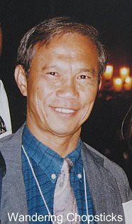
In 1984, when the film "The Killing Fields" aired on television, Cambodia meant countless atrocities and sadness. The Khmer Rouge killed 25% of Cambodia's population, an estimated 1.5 to 2 million people died from starvation, forced labor, or were massacred. Cambodia's population in 1975 was about 7.5 million. The movie is the reenactment of Dith's story, of his escape from Cambodia, and the horrors he witnessed. He coined the term "The Killing Fields." I was honored to meet him in 1997. I'd encourage you to read the New York Times' obituary and special section on Dith to gain more insight into this remarkable man.

Dith Pran

In college, I volunteered to tutor Southeast Asian (mainly Cambodian) kids at a drop-in center in Chicago's Uptown neighborhood. Many of the kids came from dysfunctional families. Their parents had gambling and alcohol addictions, and untreated psychological trauma from enduring the Killing Fields firsthand.

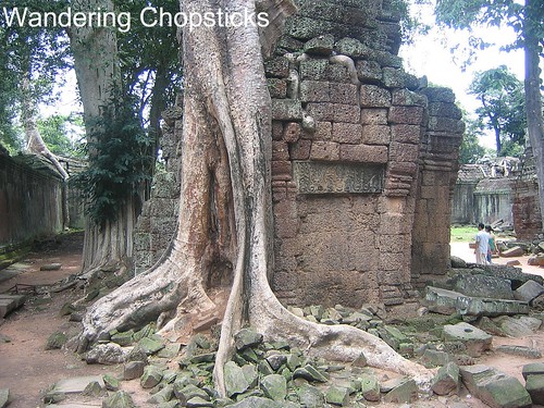
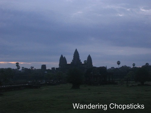
Years and years later, during the summer of 2005 when I was in Vietnam, I and two friends went to Siem Reap, Cambodia for the weekend to explore the Angkor archaeological ruins. (Don't worry, I'll show you see the pretty pictures of Angkor Wat and other temples in later posts.)

I knew about the Tuol Sleng Genocide Museum in Phnom Penh and asked if there was something in Siem Reap as well. On the last day of our trip, our tour guide took us to a Buddhist monastery where skulls and bones of victims of the Killing Fields were laid to rest.